Friday, April 19, 2024
Fair, 74°Wind: 5.8 mph, W

Welcome to our new web site!
To give our readers a chance to experience all that our new website has to offer, we have made all content freely avaiable, through October 1, 2018.
During this time, print and digital subscribers will not need to log in to view our stories or e-editions.
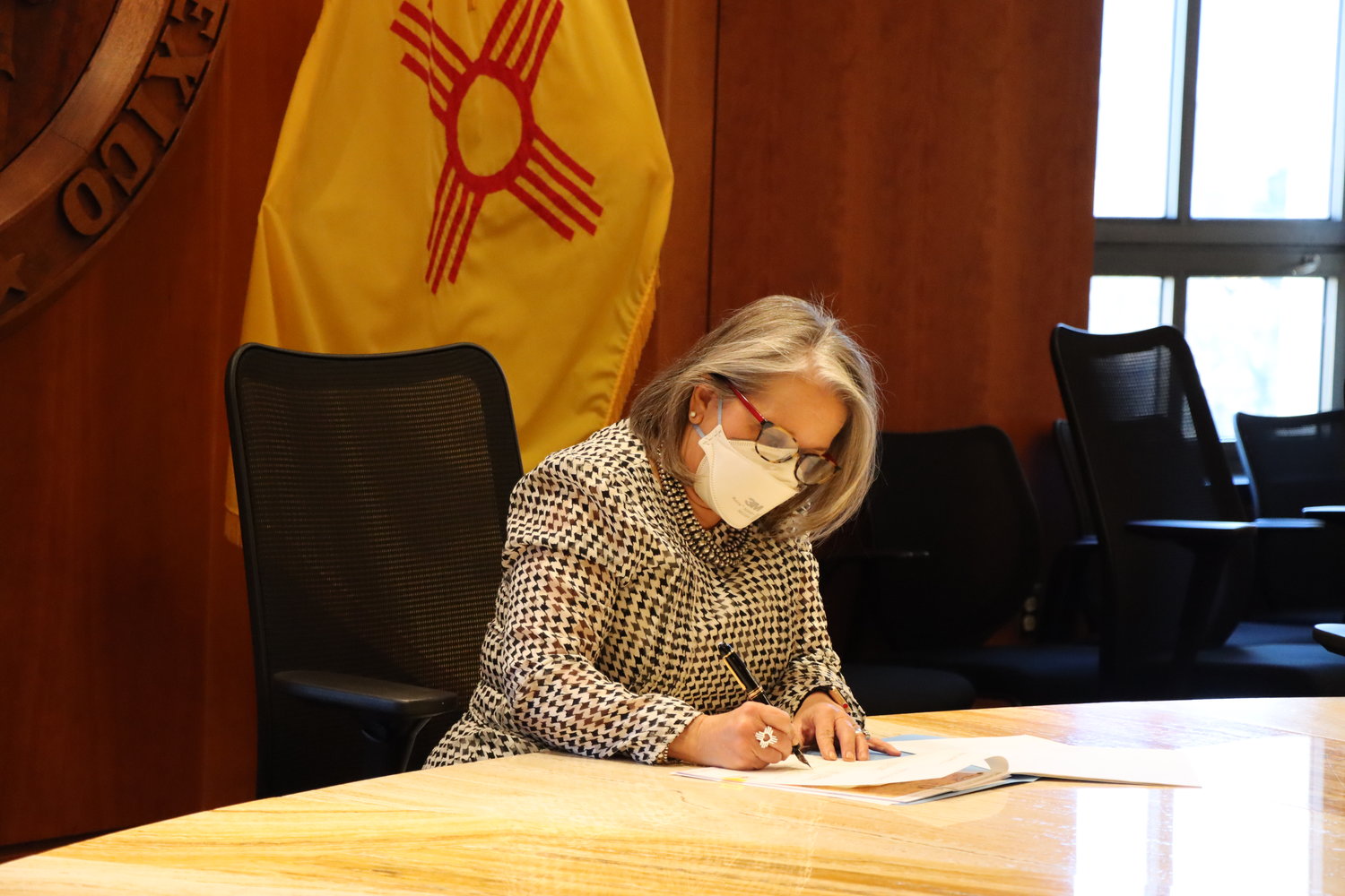


SANTA FE – Gov. Michelle Lujan Grisham on Friday signed legislation that updates the boundaries of New Mexico’s three Congressional districts based on 2020 Census data.
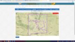
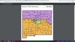
The New Mexico Legislature crafted and approved the new statewide Congressional map.
According to the New Mexico House of Representatives, the map is a “nearly 90 percent reflection” of what was called the “People’s Map,” produced by an independent Citizens Redistricting Committee.
“The people’s elected representatives in the New Mexico Legislature have spoken with respect to data-driven and representative new Congressional boundaries,” said Gov. Lujan Grisham. “It is my duty to ratify the will of the majority here, which I believe has established a reasonable baseline for competitive federal elections, in which no one party or candidate may claim any undue advantage. New Mexico is a vast and diverse state, with both rural and urban communities and interests that span the spectrum politically and economically. We must honor the ideals of American democracy by doing everything we can to ensure a level playing field, reflecting what is unique about New Mexico, on which these good faith interests may compete for political representation.”
The Congressional map was sponsored by Rep. Georgene Louis, Sen. Joseph Cervantes and Sen. Daniel Ivey-Soto.
The governor also signed House Bill 9, updating the districts of the state Public Education Commission.


